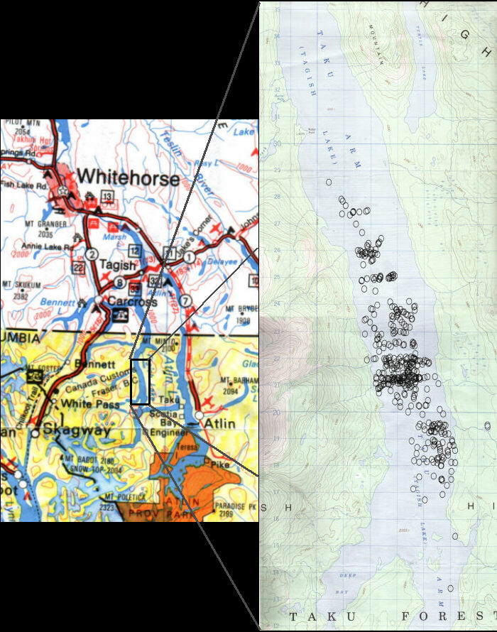
Map of Meteorite Impact Sites
(Over 500 fragments recovered)
The map at right was part of a joint press release between University of Calgary and The University of Western Ontario on May 31, 2000. Each grid square measures one square kilometre. To place this location in perspective, the map at left was added. It is truly amazing and fortunate that the debris field lined up so well with Tagish Lake making recovery rather easy; as if the meteorite was using Tagish Lake as a runway. A full resolution version of the University of Ontario map can be found on their site: here.
 RETURN TO " YUKON FIREBALL
PAGE"
RETURN TO " YUKON FIREBALL
PAGE"