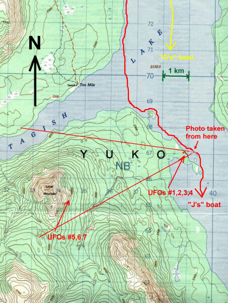
Map of Tagish Lake, Yukon Territories, Canada
Map showing sighting location and the approximate paths of George's("G’s") and Jim's("J’s") boats. The captured angle of the photograph is shown by the two red lines with the origin showing Jim's location. Seven red dots show possible locations of the seven UFOs. Grid on the map is 1 kilometer UTM Grid (approx. 0.6 miles). Elevation contours are at 100 feet intervals. This figure was created by scanning a portion of a 1:50,000 scale map. Map sheet #105D/1.
 RETURN TO TAGISH LAKE REPORT